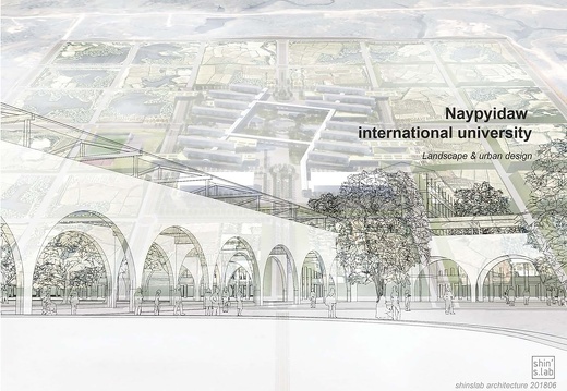
NAYPYIDAW INTERNATIONAL CAMPUS_MYANMAR
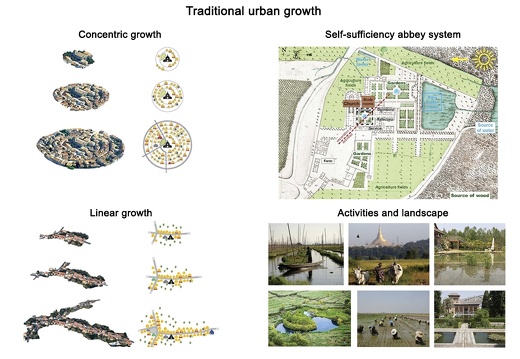
Methods employed historically to build cities were devised to ensure resilience. This project is an act of foundation in its capacity to adapt resiliently over time.
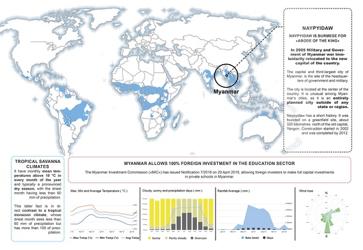
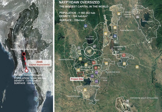
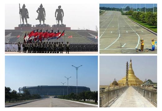
NayPyiDaw was created ex-nihilo in the centre of the country as the capital of Myanmar since 2005 to govern a territory inhabited by 135 ethnic groups.
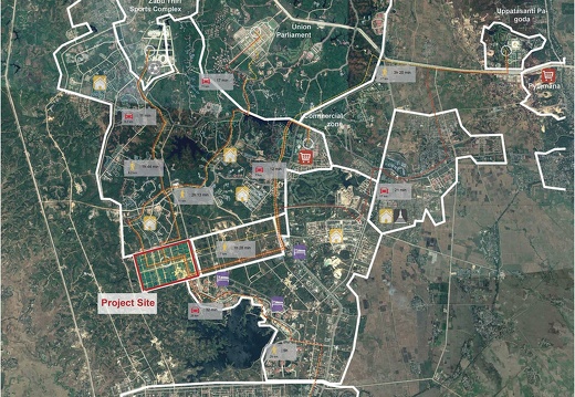
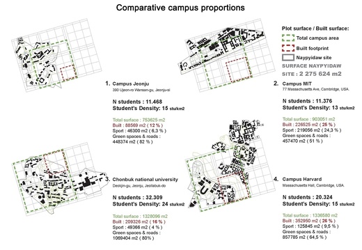
Planning an international university on 150Ha in the new capital of this isolated country is an exceptional opportunity and challenge.
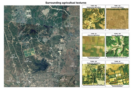
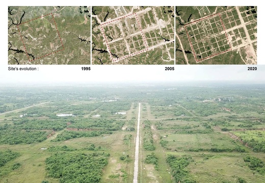
This campus inserted between the natural landscape of wooded, cultivated countryside before 2000 and “the new town artifice” with its road grid dug in 2005, becomes a new spatial “texture” to create inhabitable spaces, while maintaining the regional agriculture.
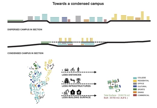
The project adapts to the tropical savannah climate: building only 4.3% of the site, respecting the orientation of the sun and dominant wind direction, temperature and rainfall.
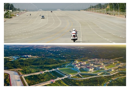
NayPyiDaw brings into question the significance of creating a new town out of nothing. Gigantic zones and facilities, linked by oversized roads that scarify the land with significant deforestation: everything is ready for a modernity that may never come.
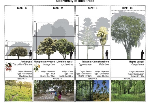
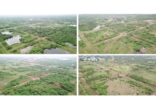
The agricultural landscape of the surroundings bears witness to a regional culture and activities. This campus preserves and re-inserts them as textures defining the use and aspect of ground.
The biggest risk is climatic disruption with global warming, torrential rain causing flooding and landslides.
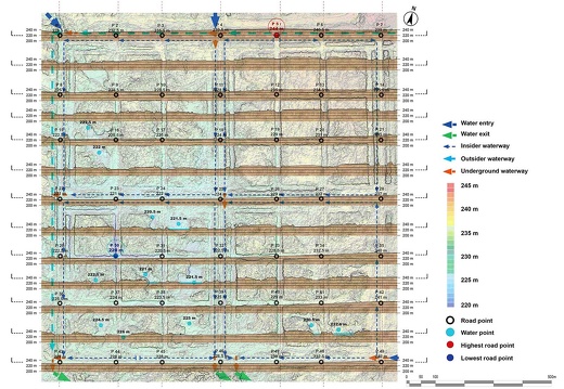
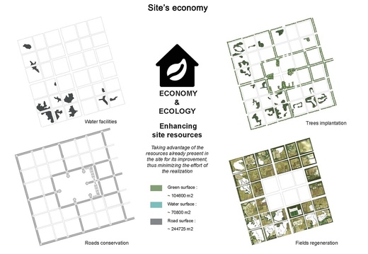
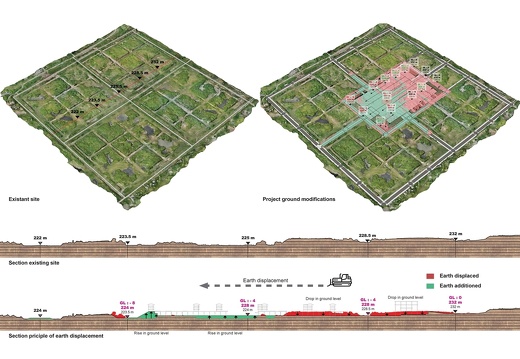
The project stabilizes the trenches created by the road network, manages the slopes for rainwater flow, maintaining the geological strata and natural basins.
The Campus is designed as an urban generator and thought in the medium to long-term, matching the progression of the university, an urban intensity with land and financial viability.
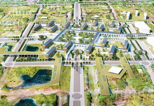
The buildings are surrounded by agricultural fields, aquaculture, aquaponics systems for food sufficiency, a water treatment plant for water autonomy, solar panels and wind power devices for autonomous energy production.
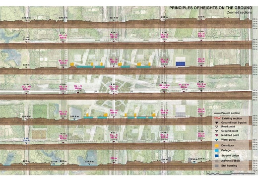
The student residences are located at the level of the “original” topography, with irrigated vegetable patches and orchard gardens continuous with the environs. They facilitate the communal living, protected from flooding.
The teaching spaces are at the level of the city road network, 8m lower. They take advantage of the cooling shade. A minimal movement of soil is necessary, given the dual level of the project.
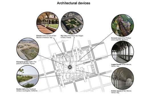
Pedestrian and cycling bridges, stretch above the roads into the surrounding fields and a two-level circulation cloister, sheltered from the sun and rain, links all the buildings on the campus.
The local building crafts and traditional know-how can be revived in the project. Construction privileges local teak, renowned for quality, availability and its integration in the landscape.
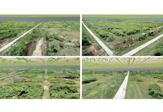
A digital model of the site was made from a scanning survey by drone. A point cloud and textured mesh were generated. Both the project and the site model co-existed in all projections throughout the development of the conception. The precision and level of material detail of the modelling allowed for a subtle and thorough understanding of the features and character of the territory, the observation of activities and their spatial deployment.
Sản phẩm của Piwigo
| Liên hệ với Quản trị
